Island owners often assume that owning the land automatically gives control over the surrounding water and seabed. In reality the rights are split into distinct layers – foreshore, seabed, water column and fisheries – each with its own legal framework. Understanding these layers helps you avoid costly disputes and plan sustainable development.
The practical impact is that you may need separate licences or concessions to build a jetty, lay underwater cables, or allow commercial fishing near your island. Failing to secure the correct rights can halt projects, attract enforcement actions, or require you to pay retroactive fees. Below we map the typical hierarchy of marine rights and explain how they interact with a land title.
What “foreshore” and “seabed” actually mean
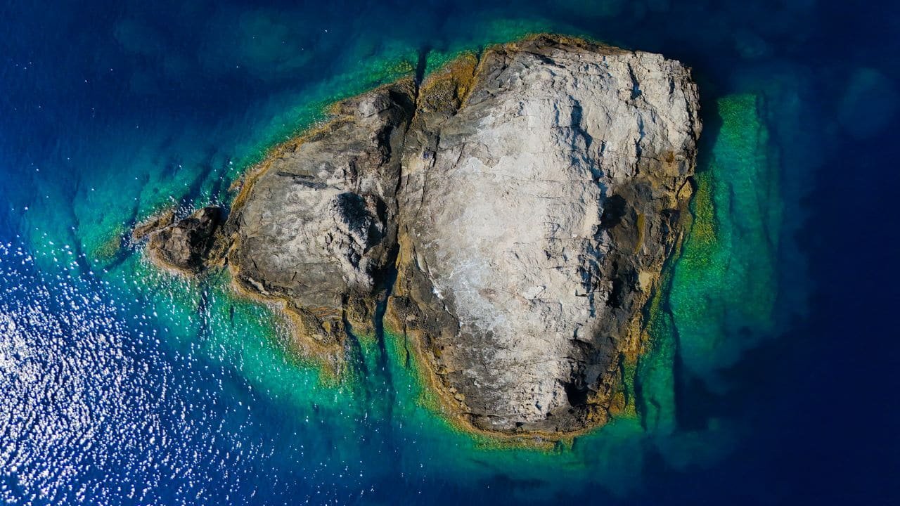
The foreshore is the land area between the high-water mark and the low-water mark. In many jurisdictions it is part of the public domain, even if the island itself is privately owned. The seabed lies beneath the foreshore and extends outward to the limit of the state’s territorial waters (usually 12 nautical miles). Ownership of the seabed is often vested in the Crown, the state, or a designated public body, not the private landowner.
Who owns the seabed around an island?
Ownership varies by jurisdiction. In Commonwealth countries the seabed is typically owned by the Crown and managed through a concession system. In some Caribbean states the seabed may be privately owned if a historic title exists, but such cases are rare and require thorough title research. In most cases you will need to apply for a marine concession or lease from the relevant marine authority.
Marine lease terms for island owners
A marine concession is a contract that grants you the right to use a defined area of the seabed or water column for a specific purpose – for example, a marina, a renewable-energy turbine, or an underwater pipeline. Key terms usually include:
- Duration – often 20-30 years, with options to renew.
- Scope of use – precise activities permitted and any exclusion zones.
- Fees – an upfront licence fee and/or an annual rent, which varies by jurisdiction and the commercial value of the activity.
- Environmental obligations – mandatory impact assessments and ongoing monitoring.
- Termination rights – conditions under which the authority can revoke the concession. Because fees and conditions differ widely, you should obtain a written fee schedule from the local marine authority and compare several proposals before committing.
The water column and fisheries rights
Above the seabed lies the water column, the space occupied by the sea itself. In most legal systems this is a public resource. Fishing rights are frequently allocated through separate licences that may be granted to individuals, cooperatives or commercial operators. An island owner may be able to negotiate a co-management agreement, but the right to control commercial fishing is rarely included in a standard seabed concession.
Mooring and anchorage rights
Mooring buoys, floating docks and anchorage zones are usually regulated under navigation or port authority rules rather than property law. If you wish to provide private mooring for guests, you will often need a specific mooring licence that defines the number of vessels, the size of the mooring area and safety standards. These licences are typically issued by the same body that manages the marine concession, but they are separate instruments.
Overlapping jurisdictions and cross-border issues
Many islands sit near the edge of a nation’s exclusive economic zone (EEZ). The EEZ extends up to 200 nautical miles and gives the state rights over natural resources, including fisheries and seabed minerals. If your island lies close to another country’s EEZ, you may encounter overlapping claims, especially for offshore wind or oil projects. In such cases, bilateral treaties or regional agreements dictate which authority grants concessions.
How to verify your marine rights
- Obtain the island’s title deed – confirm whether it mentions any foreshore or seabed rights.
- Check the national land registry – many registries record separate marine titles.
- Consult the marine authority – request a map of existing concessions and any pending applications.
- Engage a local solicitor – they can interpret the jurisdiction-specific statutes and advise on the steps needed to secure a concession.
- Commission a hydrographic survey – this defines the exact limits of the seabed area you wish to use and supports the concession application.
Common mistakes island owners make
| Mistake | Why it hurts | How to avoid |
|---|---|---|
| Assuming land title includes seabed | Leads to unauthorised works and fines | Check the title and ask the marine authority about separate rights |
| Ignoring environmental licences | Projects can be halted by regulators | Conduct an early impact assessment and incorporate mitigation plans |
| Over-looking renewal clauses | Concession may expire before project completion | Negotiate clear renewal options and budget for future fees |
| Not mapping the foreshore accurately | Causes disputes over shoreline erosion works | Use a professional survey to define high-water and low-water marks |
| Treating fishing rights as part of a marina concession | May result in illegal fishing activities | Secure separate fisheries licences where required |
Steps to secure a marine concession (process checklist)
- Pre-application research – Identify the governing marine authority and collect existing concession maps.
- Define the project area – Commission a hydrographic survey to establish boundaries.
- Prepare documentation – Include environmental impact studies, engineering plans and a financial proposal.
- Submit the application – Pay any required filing fees and await the authority’s review.
- Negotiate terms – Clarify duration, fees, renewal rights and environmental obligations.
- Execute the concession deed – Sign the agreement, register it where required, and obtain any ancillary licences (e.g., mooring).

Who Owns the Seabed Around an Island?
The legal owner of the seabed depends on the jurisdiction in which the island sits. In many Commonwealth territories, the Crown retains ownership of the foreshore and seabed, granting licences to private owners. In contrast, some Caribbean nations treat the seabed as part of the private parcel once the island is surveyed and registered.
Before finalising a purchase, request the title deed and any accompanying marine licence documentation. Verify whether the deed includes a “seabed clause” or if a separate concession is required. In jurisdictions where the seabed is state-owned, the buyer will need to apply for a marine lease before any development can commence.
A common mistake is assuming that land ownership automatically extends to the surrounding waters. This is rarely the case; the boundary is often defined by a statutory “tidal line” or a fixed distance (e.g., 200 m) from the high-water mark. Clarify this limit early to avoid costly renegotiations later.
Marine Lease Terms for Island Owners
Marine leases typically run for a fixed term—often 20 to 99 years—subject to renewal options. The lease will specify permitted uses, such as dredging, anchorage, or renewable-energy installations. It may also impose environmental covenants, requiring impact assessments before any works begin.
Key cost drivers include the lease premium (a one-off payment), an annual rent, and any performance-based fees tied to the volume of extraction or development intensity. In some jurisdictions the rent is a percentage of gross revenue from marine activities; elsewhere it is a flat rate set by the ministry of marine resources.
When negotiating, ask the lessor about escalation clauses. Some leases automatically increase the rent every five years in line with inflation or market rates. Understanding these mechanisms helps you model long-term cash-flow impacts accurately.
Foreshore and Seabed Rights Explained
The foreshore is the area between the high-water mark and the low-water mark. In many legal systems, this strip belongs to the state, even if the island itself is privately owned. The seabed begins at the low-water mark and extends outward to the jurisdiction’s maritime boundary, which may be defined by a fixed radius or by the United Nations Convention on the Law of the Sea (UNCLOS) limits.
Ownership of the foreshore can affect construction of piers, jetties, or beach amenities. If the foreshore is public, you will need a separate permit from the coastal authority. The seabed, on the other hand, is where you may lay foundations for offshore structures, install moorings, or harvest marine resources.
Distinguishing between these zones is crucial when commissioning a survey. A hydrographic survey will map the seabed, while a topographic survey will capture the foreshore profile. Both are required for a complete rights assessment.
Checks to Perform Before Signing
- Title Search – Obtain a certified copy of the island’s title register and any associated marine licences. Look for annotations about foreshore or seabed reservations.
- Survey Reports – Secure recent hydrographic and topographic surveys. Verify that the surveyed limits match the legal boundaries on the title.
- Environmental Clearance – Confirm whether an Environmental Impact Assessment (EIA) is mandatory for your intended use of the seabed. Some jurisdictions waive the EIA for low-impact activities but not for dredging or energy projects.
- Regulatory Ledger – Request a list of all licences, permits, and consents held by the current owner. Missing documentation is a red flag.
If any of these items are incomplete, negotiate a conditional settlement or ask the seller to remedy the gaps before closing.
Questions to Put to a Lawyer or Surveyor
- What is the exact statutory definition of the foreshore in this jurisdiction, and does it affect my intended development?
- Are there any pending legislative reforms that could alter marine lease terms or increase fees?
- How does the jurisdiction treat offshore renewable-energy installations on privately owned seabed?
- What are the customary notice periods for renewing or terminating a marine lease?
- Can the lease be transferred to a future owner without consent, or is a re-licencing process required?
A competent maritime lawyer will also advise on dispute-resolution mechanisms, such as arbitration clauses, that are often embedded in marine lease agreements. A qualified surveyor will confirm whether the physical boundaries align with the legal description, preventing costly boundary disputes after purchase.
Frequently asked questions
Does owning an island automatically give me rights to the surrounding water?
No. Land ownership usually stops at the high-water mark. Rights to the foreshore, seabed and water column are governed by separate statutes and often require a concession or licence.
Can I sell seabed rights separately from the island?
In most jurisdictions seabed rights are not sellable as private property; they are licensed by the state. You can, however, assign a concession to a third party, subject to the authority’s approval.
What is the difference between a concession and a lease?
A concession is a grant of a public right to use a resource (e.g., seabed) for a defined purpose, often with regulatory conditions. A lease typically refers to the rental of private property. Marine concessions are issued by the state, not by the landowner.
How long do marine concessions usually last?
Durations vary, but many are set for 20-30 years with renewal options. The exact term depends on the jurisdiction, the nature of the activity and the environmental assessment outcomes.
Are there any tax implications for marine concessions?
Concessions may be subject to licence fees, annual rents and, in some jurisdictions, specific taxes on resource extraction. Because tax regimes differ, you should seek advice from a local tax specialist.
What to do next
- Review your island’s title deed for any mention of foreshore or seabed.
- Contact the relevant marine authority to request a map of existing concessions.
- Engage a local solicitor experienced in marine law to assess the steps required for your project.
- Commission a hydrographic survey to define the exact area you need.
- Prepare a preliminary environmental impact assessment before submitting any concession application.
This article is general information, not legal, tax or financial advice. Island ownership, taxation and planning rules differ by jurisdiction, so verify every point with a qualified local lawyer, notary, surveyor or tax adviser before you commit.